This road runs between Tbilisi to Vladikavkaz (always just rolls off the tongue!) just over the border in Russia. Although the route was known since ancient times (Pliny apparently mentioned it), the present road dates from the 1800s when the Russians built it as the main route through the region. It was a major project at the time, and when it was finally completed in 1863 had cost £4 million at that time, which was a staggering cost.

The road run down the right side of this valley…
Georgia/Caucasus appears to feature quite heavily in 19th century Russian literature – one book I read (and I forget which) compared the image of Georgia in Russian literature as being akin to the Wild West in Hollywood – a completely romanticised image of wild untamed nature full of men trying to make their mark and survive in this harsh landscape. Many of the greats of Russian literature travelled to this region (in fact served as soldiers during Russian campaigns in the 19th century) and fell in love with and wrote about the region – this includes both Pushkin and Tolstoy. However, the writer who is really connected to this region is Lermontov – I’d never heard of him until I booked the holiday, but his novel ‘A Hero of our Time’ – which according to the blurb on the back of the book is viewed as the First Great Russian Novel, is set entirely in the region. I mention this now because the first chapter of the book is set on the Georgian Military Highway as the narrator of the story travels north along it… The book is a bit like a Russian version of Dangerous Liaisons if you’re interested, and it seems Lermontov’s life progressed in a form scaringly similar to its central character, down to his death in a duel over a woman (in the Caucasus).

The importance of the road has declined over the years, but it still remains one of the main routes in the region. Our tour guide told us that it was particularly important for Armenia – and they had particularly struggled when it was closed during the 2008 War.

The road starts to get interesting at around Ananuri, a beautiful 18th century castle that now perches above the deep blue of the reservoir of the nearby Gadauri dam – yeah, that lake isn’t natural. The area was flooded in the 1950s on the orders of Stalin, flooding the original Military Highway, and the Castle only narrowly escaped the same fate.
From here the landscape becomes much more dramatic, and the road condition also becomes a lot worse!

However, it was the final stretch we did to Kazbegi (see previous entry) that was slow due to the road condition; there is a lot of swerving large potholes and drives through what look like not particularly safe snow tunnels – which is always fun when you have find a massive truck coming the other way. Delays happen on a regular basis here, either due to accidents or to roadworks, and some of the driving is utterly and selfishly insane, but the road doesn’t get closed that often – even in winter it’s kept open for at least some of the day. Well, or night, as the road can actually be safer then as avalanches are less likely to happen in the cold darkness.

The Military Highway with one of the tunnels…
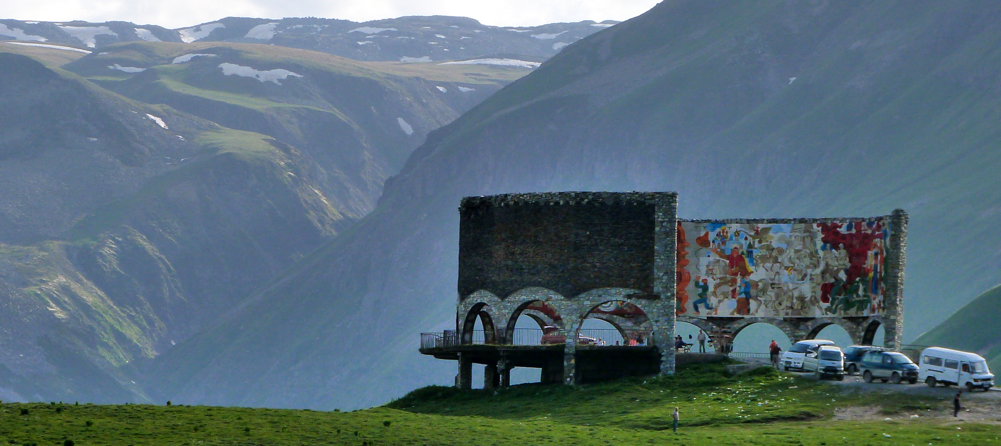
This huge colourful monument is the Soviet Monument to commemorate 200 years of ‘friendship’ between Georgia and Russia – I use the inverted commas because our tour guide let out a snort when telling us this. But it was built in 1983 to commemorate the 200th anniversary of the first formal alliance between Georgia and Russia – a treaty the Georgian signed in order to get Russian military assistance against the Persians and Turkish invasions. Not that it helped, as the Persians utterly destroyed Tbilisi in 1795… but there you go… It was the start of Georgia’s absorption into the Russian Empire. I loved it!

Full of symbolism that I really don’t understand…
The last two photos are from a short walk we did from the Georgian Military Highway, close to the Russian border (or more correctly close to the 3km no man’s land that exists between the Georgian and Russian border). Beautiful landscape.

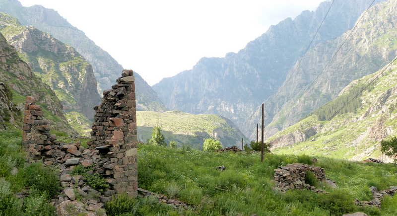
The ruined tower above is one of a chain of towers build by King David the Builder in the 12th century. The towers served as a warning device should the region be in trouble invaded. A fire was lit in the tower to relay a message to the next tower… etc., etc. Most of the towers are now in various state of ruins: either pillaged by locals for stone, or destroyed by the invading Mongols in the 13th century. They litter the landscape of this part of Georgia.


